At Kraina Lab, we embark on pioneering studies, leveraging advanced technologies and analytical methodologies to unravel the intricate complexities of geospatial phenomena and mobility patterns. Our interdisciplinary approach empowers us to extract meaningful insights from vast datasets, revolutionizing the understanding of urban dynamics, transportation systems, and spatial interactions.
We are a part of the Department of AI at Wrocław Tech’s Faculty of Information and Communication Technology.
Our Key Areas of Focus:
📍 Geospatial Analysis: Employing state-of-the-art spatial data processing techniques, we discern spatial relationships and distribution patterns, uncovering crucial spatial trends.
🚗 Mobility Insights: Through extensive data mining and modeling, we investigate the dynamics of human and vehicular mobility, optimizing transportation networks and fostering sustainable urban development.
🗺️ Urban Dynamics: Merging urban studies with geospatial analytics, we dissect the drivers behind urban growth, land use changes, and urban sprawl, informing evidence-based urban planning strategies.
🔓 Open source: At Kraina we are actively improving the tooling around the geospatial domain. Take a glimpse into our projects:
Spatial Representations for Artificial Intelligence
![]()
Project Spatial Representations for Artificial Intelligence (srai) aims to provide simple and efficient solutions to geospatial problems that are accessible to everybody and reusable in various contexts where geospatial data can be used. It is a Python module integrating many geo-related algorithms in a single package with unified API.
See SRAI for more information.
Map Diffusion - Text Promptable Map Generation
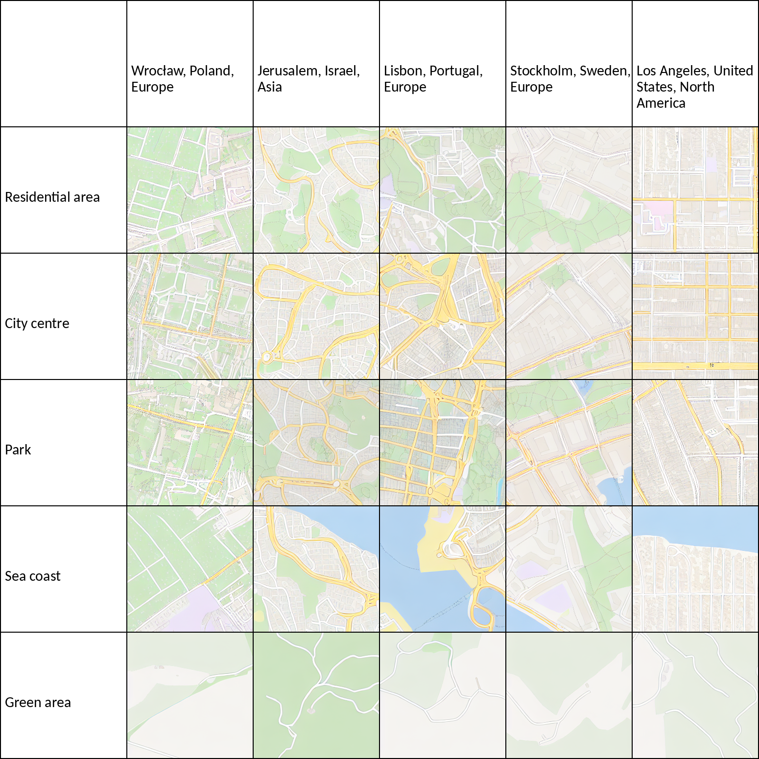
Map Diffusion is a novel text promptable map generation model, leveraging recent advancements in generative models. Promptable map generation has broad applications, democratizing access to geographic data, enhancing decision-making, improving communication, and enabling customization. Map Diffusion generates maps based on textual descriptions, allowing users to describe a region, and the model generates a corresponding map.
See the model for more information or visit the publication.
Bicycle Sharing System - Station Location Recommendation
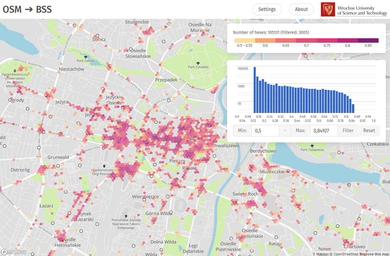
Based on data collected from 34 European cities, a method for automatically generating a heat map has been developed to support planners in developing the layout of bike sharing stations. The model was developed as part of a Master’s thesis and published at the ARIC workshop at SIGSPATIAL 2021. The website allows the user to view all generated results for different cities of the world for many of the available heat map models with the possibility to change the colour scheme and style of the map.
See the website for more information or visit the publication.